
Unofficial Oaklandon Community Website
Who's Online
Visit Nextdoor

The private social network for your neighborhood.
Throw The Dog A Bone

User Functions
Find Us On Facebook
Welcome to Oaklandon, Anonymous Saturday, October 10 2026 @ 01:31 pm EDT
History
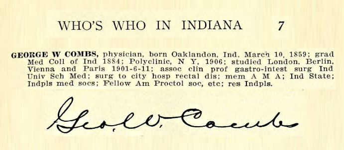
George W. Combs' Signature


- Wednesday, October 25 2017 @ 06:53 am EDT
-
- Contributed by:
- Mike
-
- Views:
- 3,031
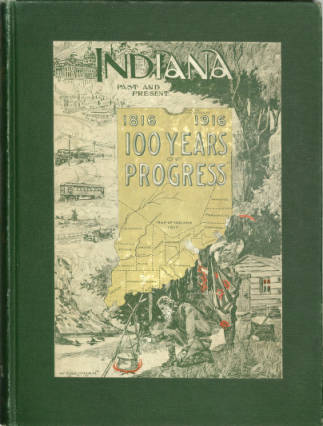
Found the Signature of George W. Combs in the book:
Indiana Past and Present 1816 to 1916 100 Years of Progress [pg467]
Â
Â
- Trackbacks (0)
Eureka - Paradise!
- Friday, October 20 2017 @ 09:02 am EDT
-
- Contributed by:
- Mike
-
- Views:
- 4,618
One of the major reasons for beginning this Unofficial Oaklandon Community Website was the frustration I felt when trying to revisit an article I remembered seeing on the internet many years ago; unable to find it to spite countless searches. I knew it was an article dealing with Oaklandon history and spoke of the neighborhood of Paradise (located on the southern edge of Oaklandon.)
This effort served to motivate me to collect as much Oaklandon related content as I could in an attempt to make this a repository (of sorts) for all things Oaklandonish.
On a visit today to The Program of Digital Scholarship at IUPUI University Library; a search on Oaklandon revealed a digital edition of the 1994 Indiana University Press publication:
 The Encyclopedia
of Indianapolis
Edited by DAVID J. BODENHAMER
and ROBERT G. BARROWS
with the assistance of David G. Vanderstel
A PROJECT OF THE POLIS RESEARCH CENTER OF INDIANA UNIVERSITY-PURDUE UNIVERSITY, INDIANAPOLIS
The following excerpt (from pages 1200~01 by Glory-June Greiff) contains those very words for which I have been seeking:
During the 1920s the highway department began to construct bypasses around the business centers of larger cities and entirely past smaller villages, such as that of S.R. 67 around Oaklandon. New buildings containing businesses geared toward the highway traveler, such as short order restaurants and filling stations, appeared along these bypasses and approaches to towns. Paradise, now a group of rental properties on the south side of Oaklandon, began as a motley collection of tourist cabins, along with a grocery and gas station, serving the new S.R. 67 bypass in the late 1920s. There still exist scattered examples of this development along the present but especially the former state highway routes in Marion County, which give clues as to the past suburbanization of Indianapolis.ÂÂÂ
Detail of 1915 Map showing Paradise Tourist Camp
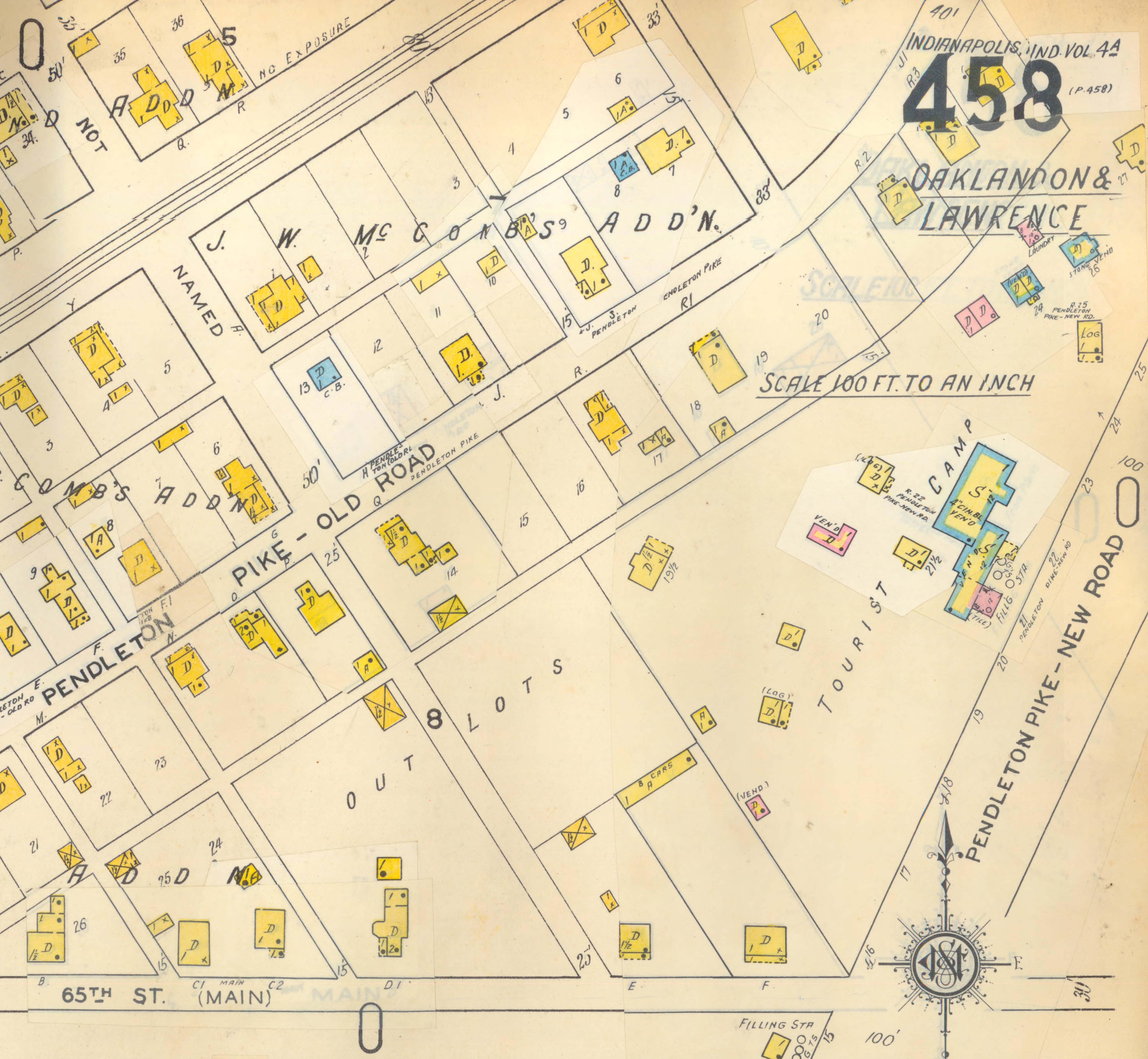
Indianapolis Sanborn Map #458, 1938
Paradise Lost No Longer!
- Comment (0)
- Trackbacks (0)
O.H.S. 1900 - Football Team
- Friday, October 20 2017 @ 06:23 am EDT
-
- Contributed by:
- Mike
-
- Views:
- 2,416
![Foot Ball Team from Oaklandon Ind. ["O.H.S. 1900" on football]](/stories/OHS_FootballTeam-1900.jpg)
- Comment (0)
- Trackbacks (0)
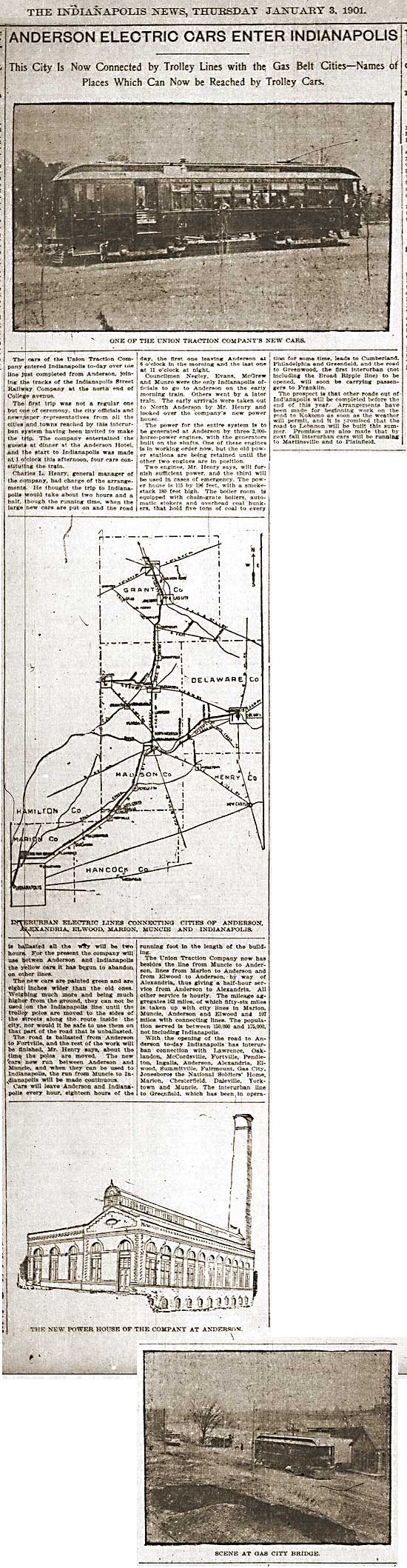
ANDERSON ELECTRIC CARS ENTER INDIANAPOLIS
- Friday, October 20 2017 @ 05:13 am EDT
-
- Contributed by:
- Mike
-
- Views:
- 11,613
- Comment (0)
- Trackbacks (0)
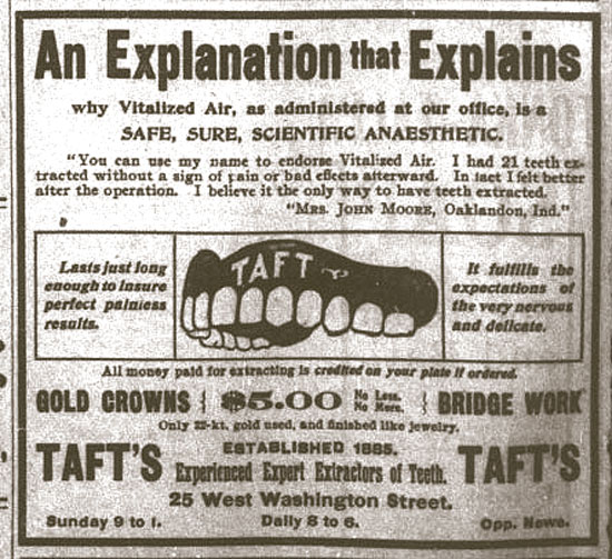
An Explanation that Explains
- Tuesday, August 15 2017 @ 02:02 am EDT
-
- Contributed by:
- Mike
-
- Views:
- 1,357
- Comment (0)
- Trackbacks (0)
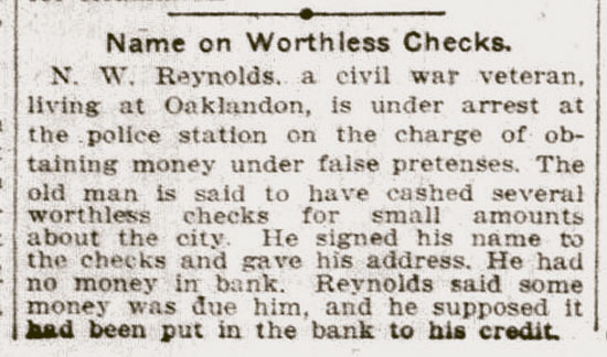
Name on Worthless Checks.
- Tuesday, August 15 2017 @ 01:27 am EDT
-
- Contributed by:
- Mike
-
- Views:
- 1,772
- Comment (0)
- Trackbacks (0)
Mock Cemetary
- Wednesday, March 15 2017 @ 07:42 am EDT
-
- Contributed by:
- Mike
-
- Views:
- 5,588
Source: http://physics.bgsu.edu/~stoner/gen/mockcem.htm
A list of gravesite occupants for:
MOCK CEMETERY, Lawrence Twsp., Marion Co., IN
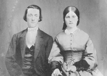 Location: North latitude 39 deg. 52.08 min. ; West longitude 85 deg. 58.04 min.. Cemetry is on the west edge of Oaklandon , IN, just north of of Indiana Road 67 (US 36), and just east of Indian Creek Bridge, Lawrence Twp., Marion County on property originally deeded to the community by Christopher Apple, Sr. The following is a transcription of a copy document I have in my Mock genealogy files. I believe the document was originally researched and prepared by Lois Chandler Apple. This cemetery is known as the Mock Cemetery because it was located in the corner of a farm which, in the late 19th Century, was owned by Alexander Mock, my great-great grandfather. (whose wife, Mary Pickle, was the granddaughter of Christopher Apple, sr.). It contains the graves of several Mock descendants of Michael Mock I (son of Thomas Mackh) and families with which they intermarried (Apple, Bolander, Pickel, Cory). Ron Stoner June 30, 1998
- Comment (0)
- Trackbacks (0)
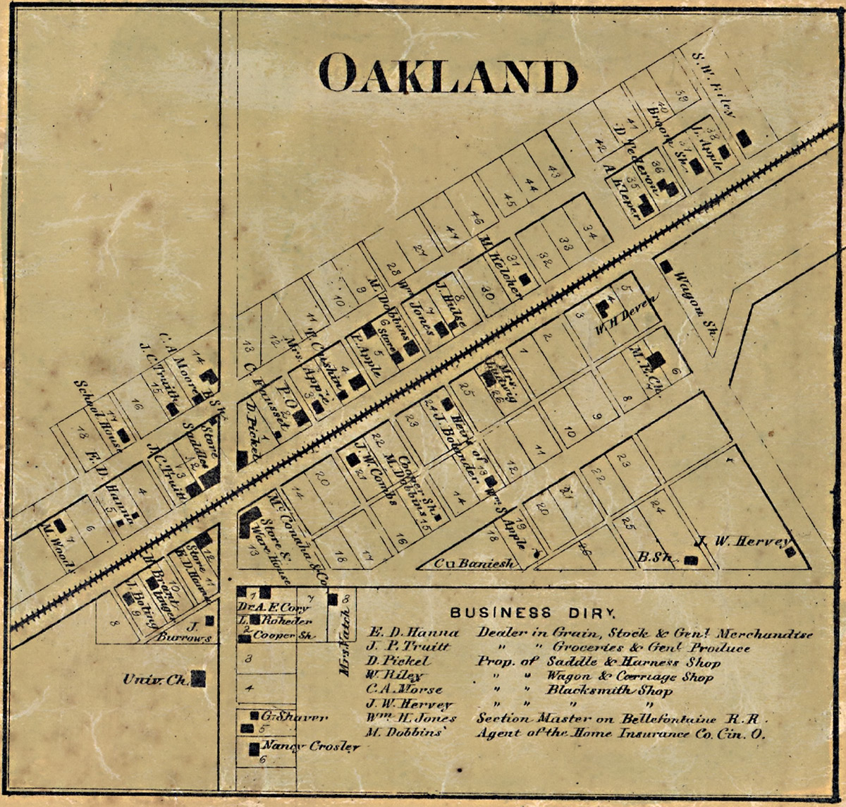
Oakland Town Map - 1866
- Friday, March 10 2017 @ 03:16 am EST
-
- Contributed by:
- Mike
-
- Views:
- 5,617
Oakland Detail from 1866 Map
of Marion County, Indiana
Created / Published - Philadelphia : C.O. Titus, Publisher, 1866.
 Click to Enlarge
Description:
"Entered according to Act of Congress in the 1865 by C.O. Titus in the Clerks Office of the District Court of the Eastern District of Pennsylvania." LC Land ownership maps, 158 Includes distance table, business directories, statistical table (1860 census), views of public and commercial buildings. Insets: Bridgeport -- Allison Ville -- Vertland -- Popular Grove -- Augusta -- Board Ripple -- West Newton -- Clermont -- Lanesville -- New Brethel -- Acton -- Cumber -- Oakland -- Southport -- Millarsville -- Spring Valley -- Mt. Jackson -- Wellington -- Hosbrook. Available also through the Library of Congress Web site as a raster image.
Source: Library of Congress
- Trackbacks (0)
More on Germantown
- Saturday, March 04 2017 @ 06:01 am EST
-
- Contributed by:
- Mike
-
- Views:
- 5,562
...
Germantown, Indiana
Germantown, Indiana, was founded in 1834 in what is now Geist Reservoir. It was actually built on the old north bank of the old Fall Creek. Residents, primarily of German heritage, from nearby Oaklandon founded the town following a disagreement over the murder of an Algonquin in Oaklandon. With just one general store, a shoemaker, a one-room schoolhouse and a mill, Germantown was very small. The town had about 20 residential properties in total.
The Start of Geist Reservoir
In the 1900s, water deficits in the Indianapolis area appeared to be impending issue. One man, Clarence Geist, a former owner of the Indianapolis Water Company, drew up plans for the creation of Geist Reservoir. The plan called for the damming of Fall Creek, which would, consequentially, flood the small town of Germantown. The obvious fate of the town did not stop the damming of Fall Creek. In 1943, the creek was dammed and began to flood the surrounding area, creating Geist Reservoir. Most of old Germantown no longer exists today. However, nearby Log Cabin Animal Hospital now occupies the oldest remaining Germantown structure.
...
Excerpt from:
FindingHomesIndy.com's "Geist Reservior" by Lisa Witsken-Gearhart
ÂÂÂ
- Trackbacks (0)
Wikipedia Says:
- Thursday, March 02 2017 @ 05:36 am EST
-
- Contributed by:
- Mike
-
- Views:
- 1,120
https://en.wikipedia.org/wiki/Lawrence_Township,_Marion_County,_Indiana
Oaklandon
The Oaklandon Historic District is located in the northeast corner of Lawrence Township in northeastern Marion County, and encompasses a portion of the mid-19th century settlement known as Oaklandon. Located approximately 14 miles northeast of downtown Indianapolis, the Oaklandon area is currently a part of the city of Lawrence, which after a six-year court battle annexed it, Indian Lake and other unincorporated parts of Lawrence Township in 1976.[6]
When Oaklandon was established in 1849 along the route of the Indianapolis and Bellefontaine Railroad, it was surrounded by farms and vacant land; now it is enveloped by the urban sprawl of Indianapolis and Lawrence. Late 20th century housing developments, many of them planned using winding streets or cul de sacs, can be seen to the south, west, and north of the community.
Just north of the district is the railroad right-of-way established in the late 1840s, and currently used by CSX Transportation. To the south is Pendleton Pike, once a toll road which passed directly through Oaklandon, running north along present day Oaklandon Road, and then west along what is now Broadway Street. Pendleton Pike was rerouted in the early 20th century so that it passed along the southern edge of the community, and is now a busy six lane thoroughfare lined with strip malls and other commercial activities. The district’s building stock is composed of small and medium-sized residences and outbuildings dating from the late 19th and early 20th centuries, along with two church buildings from the same era.[7]
Oaklandon never incorporated, and therefore had no official town limits, but appears never to have developed south of present-day Pendleton Pike. Until its demolition in the early 1940s, the community’s two story brick school stood at the northwest corner of Oaklandon Road and Pendleton Pike and would have alerted travelers of the small town just to the north. Today a modern retail development occupies the school’s site, but that development’s sign includes a panel bearing the words “Oaklandon Community established 1849.†Upon passing that sign and heading into the historic district, one immediately notices that the area differs from the surrounding commercial and residential area. The feeling of a small town is engendered by the relative narrowness of the streets and the older housing stock. That atmosphere is further reinforced by the small lots and modest setbacks that characterize the housing stock on Oaklandon Road, the older part of the district. This section of Oaklandon Road (from Pendleton Pike north to Broadway) is also the only street in the area with streetlights, curbs and sidewalks. The latter were initially installed for the benefit of the community’s children, who once walked along Oaklandon Road to the aforementioned school.[7]
- Comment (0)
- Trackbacks (0)