Unofficial Oaklandon Community Website
Who's Online
Visit Nextdoor

The private social network for your neighborhood.
Throw The Dog A Bone

User Functions
Find Us On Facebook
Welcome to Oaklandon, Anonymous Saturday, July 25 2026 @ 05:35 pm EDT
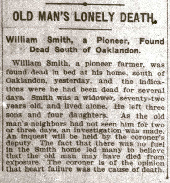
OLD MAN’S LONELY DEATH.

- Saturday, March 11 2017 @ 10:42 am EST
-
- Contributed by:
- Mike
-
- Views:
- 1,446
- Comment (0)
- Trackbacks (0)
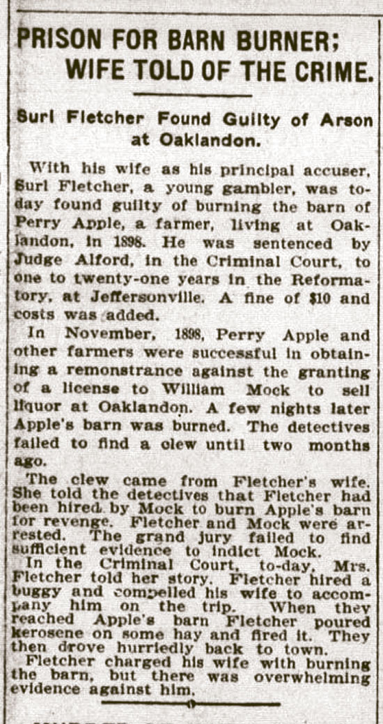
PRISON FOR BARN BURNER; WIFE TOLD OF THE CRIME.
- Saturday, March 11 2017 @ 10:30 am EST
-
- Contributed by:
- Mike
-
- Views:
- 1,084
- Comment (0)
- Trackbacks (0)
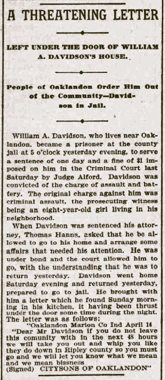
A Thretening Letter
- Saturday, March 11 2017 @ 10:17 am EST
-
- Contributed by:
- Mike
-
- Views:
- 1,177
- Comment (0)
- Trackbacks (0)
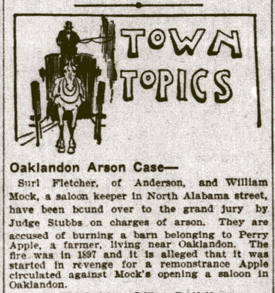
Oaklandon Arson Case
- Saturday, March 11 2017 @ 10:11 am EST
-
- Contributed by:
- Mike
-
- Views:
- 1,171
ÂÂÂ
- Comment (0)
- Trackbacks (0)
Wants to be a Town
- Friday, March 10 2017 @ 08:59 am EST
-
- Contributed by:
- Mike
-
- Views:
- 1,198
- Comment (0)
- Trackbacks (0)
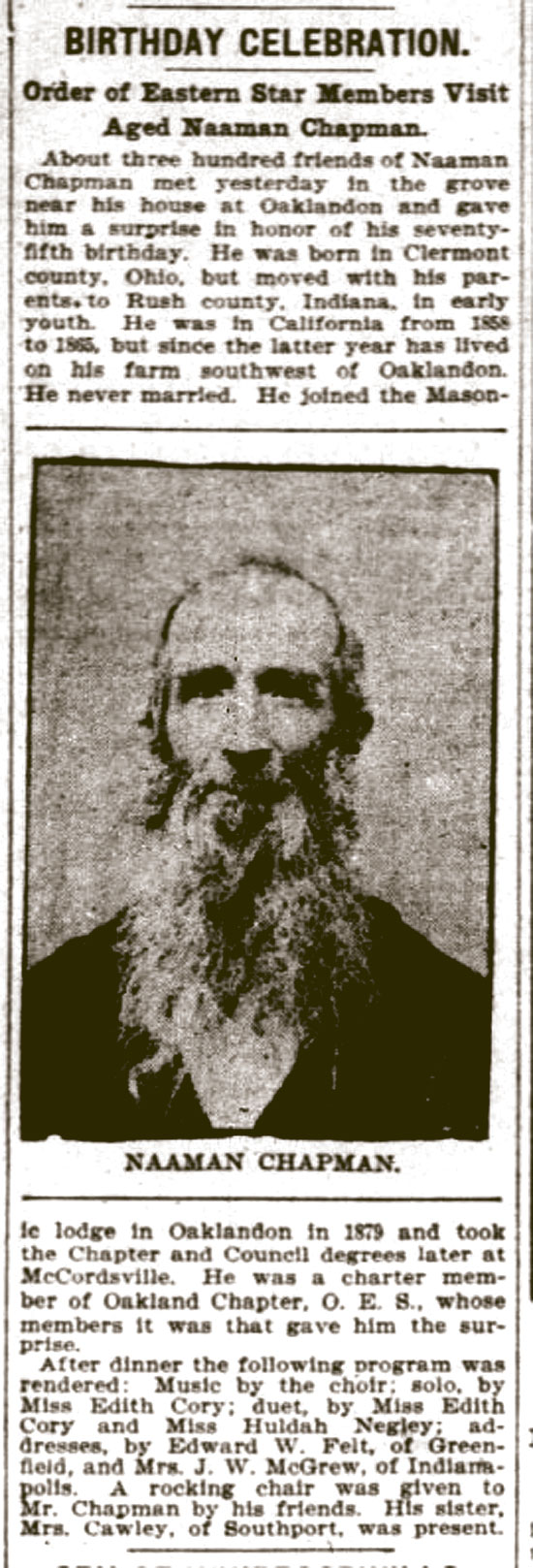
BIRTHDAY CELEBRATION
- Friday, March 10 2017 @ 08:53 am EST
-
- Contributed by:
- Mike
-
- Views:
- 1,363
- Comment (0)
- Trackbacks (0)
Oaklandon Case is Heard on Appeal
- Friday, March 10 2017 @ 08:45 am EST
-
- Contributed by:
- Mike
-
- Views:
- 1,173
- Comment (0)
- Trackbacks (0)
An Escaped Lunatic
- Friday, March 10 2017 @ 08:30 am EST
-
- Contributed by:
- Mike
-
- Views:
- 1,477
- Trackbacks (0)
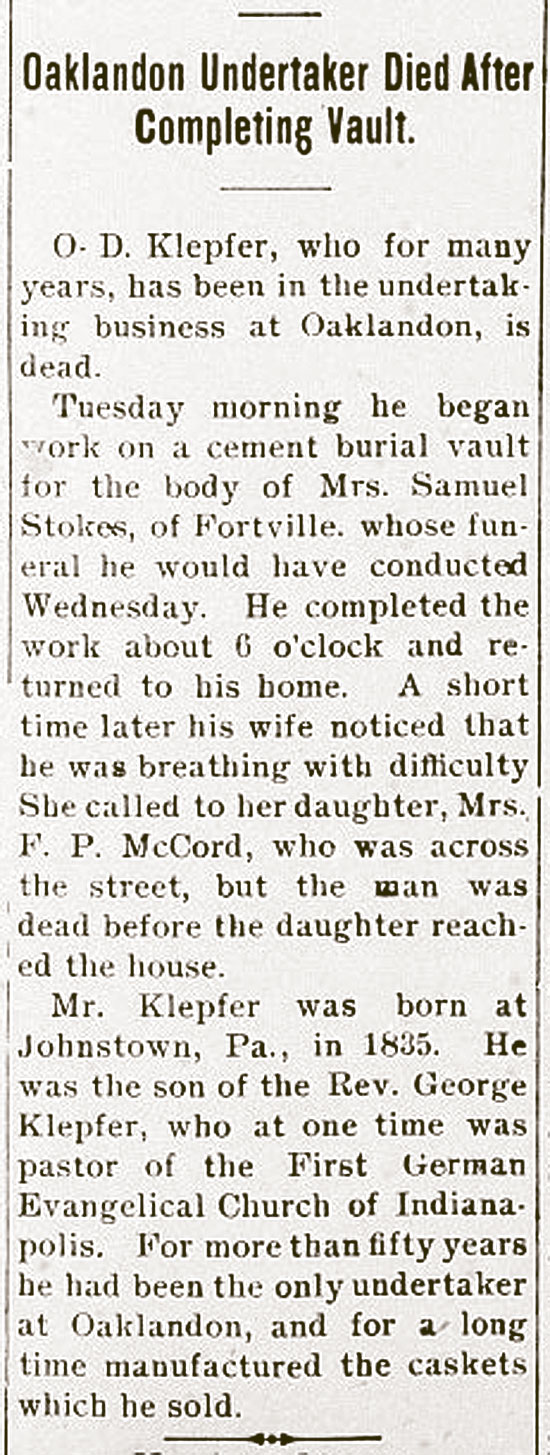
Oaklandon Undertaker Died After Completing Vault
- Friday, March 10 2017 @ 08:24 am EST
-
- Contributed by:
- Mike
-
- Views:
- 1,130
- Trackbacks (0)
Oakland Town Map - 1866

- Friday, March 10 2017 @ 03:16 am EST
-
- Contributed by:
- Mike
-
- Views:
- 5,498
Oakland Detail from 1866 Map
of Marion County, Indiana
Created / Published - Philadelphia : C.O. Titus, Publisher, 1866.
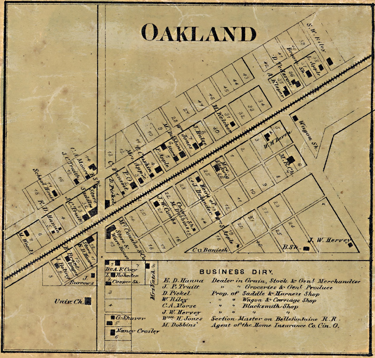 Click to Enlarge
Description:
"Entered according to Act of Congress in the 1865 by C.O. Titus in the Clerks Office of the District Court of the Eastern District of Pennsylvania." LC Land ownership maps, 158 Includes distance table, business directories, statistical table (1860 census), views of public and commercial buildings. Insets: Bridgeport -- Allison Ville -- Vertland -- Popular Grove -- Augusta -- Board Ripple -- West Newton -- Clermont -- Lanesville -- New Brethel -- Acton -- Cumber -- Oakland -- Southport -- Millarsville -- Spring Valley -- Mt. Jackson -- Wellington -- Hosbrook. Available also through the Library of Congress Web site as a raster image.
Source: Library of Congress
- Trackbacks (0)