Visit Nextdoor

Nextdoor
The private social network for your neighborhood.

Throw The Dog A Bone

User Functions

What's New

Stories last 24 hours

No new stories

Comments last 2 days

No new comments

Trackbacks last 2 days

No new trackback comments

Links last 2 weeks

No recent new links

Media Gallery last 7 days

No new media items

Topics

Find Us On Facebook

Yep, Facebook :D

Welcome to Oaklandon Friday, April 26 2024 @ 06:09 pm EDT

An Explanation that Explains

  • View Printable Version
History
  • Contributed by:
  • Views:
    998
Indianapolis News,Indianapolis, Marion County, 25 July 1901

An Explanation that Explains

Name on Worthless Checks.

  • View Printable Version
History
  • Contributed by:
  • Views:
    1,344

Indianapolis News,Indianapolis, Marion County, 23 November 1903

Name on Worthless Checks.

Mock Cemetary

  • View Printable Version
History
  • Contributed by:
  • Views:
    4,827

Source: http://physics.bgsu.edu/~stoner/gen/mockcem.htm

A list of gravesite occupants for:

MOCK CEMETERY, Lawrence Twsp., Marion Co., IN

Wedding picture of Michael Mock II (1841-1921) and Sarah Jane Cory (1844-1928).Location: North latitude 39 deg. 52.08 min. ; West longitude 85 deg. 58.04 min.. Cemetry is on the west edge of Oaklandon , IN, just north of of Indiana Road 67 (US 36), and just east of Indian Creek Bridge, Lawrence Twp., Marion County on property originally deeded to the community by Christopher Apple, Sr. The following is a transcription of a copy document I have in my Mock genealogy files. I believe the document was originally researched and prepared by Lois Chandler Apple. This cemetery is known as the Mock Cemetery because it was located in the corner of a farm which, in the late 19th Century, was owned by Alexander Mock, my great-great grandfather. (whose wife, Mary Pickle, was the granddaughter of Christopher Apple, sr.). It contains the graves of several Mock descendants of Michael Mock I (son of Thomas Mackh) and families with which they intermarried (Apple, Bolander, Pickel, Cory). Ron Stoner June 30, 1998

Oakland Town Map - 1866

  • View Printable Version
History
  • Contributed by:
  • Views:
    3,008

Oakland Detail from 1866 Map
of Marion County, Indiana

Created / Published - Philadelphia : C.O. Titus, Publisher, 1866.

Detail fom 1866 Map of Marion County, IndianaClick to Enlarge

Description:
    "Entered according to Act of Congress in the 1865 by C.O. Titus in the Clerks Office of the District Court of the Eastern District of Pennsylvania." LC Land ownership maps, 158 Includes distance table, business directories, statistical table (1860 census), views of public and commercial buildings. Insets: Bridgeport -- Allison Ville -- Vertland -- Popular Grove -- Augusta -- Board Ripple -- West Newton -- Clermont -- Lanesville -- New Brethel -- Acton -- Cumber -- Oakland -- Southport -- Millarsville -- Spring Valley -- Mt. Jackson -- Wellington -- Hosbrook. Available also through the Library of Congress Web site as a raster image.

Source: Library of Congress

Download Highest Resolution In PDF Format [46.2MB]

More on Germantown

  • View Printable Version
History
  • Contributed by:
  • Views:
    1,147

...
Germantown, Indiana
Germantown, Indiana, was founded in 1834 in what is now Geist Reservoir. It was actually built on the old north bank of the old Fall Creek. Residents, primarily of German heritage, from nearby Oaklandon founded the town following a disagreement over the murder of an Algonquin in Oaklandon. With just one general store, a shoemaker, a one-room schoolhouse and a mill, Germantown was very small. The town had about 20 residential properties in total.

The Start of Geist Reservoir
In the 1900s, water deficits in the Indianapolis area appeared to be impending issue. One man, Clarence Geist, a former owner of the Indianapolis Water Company, drew up plans for the creation of Geist Reservoir. The plan called for the damming of Fall Creek, which would, consequentially, flood the small town of Germantown. The obvious fate of the town did not stop the damming of Fall Creek. In 1943, the creek was dammed and began to flood the surrounding area, creating Geist Reservoir. Most of old Germantown no longer exists today. However, nearby Log Cabin Animal Hospital now occupies the oldest remaining Germantown structure.
...

Excerpt from:
FindingHomesIndy.com's "Geist Reservior" by Lisa Witsken-Gearhart
 

Wikipedia Says:

  • View Printable Version
History
  • Contributed by:
  • Views:
    793

https://en.wikipedia.org/wiki/Lawrence_Township,_Marion_County,_Indiana

Oaklandon

The Oaklandon Historic District is located in the northeast corner of Lawrence Township in northeastern Marion County, and encompasses a portion of the mid-19th century settlement known as Oaklandon. Located approximately 14 miles northeast of downtown Indianapolis, the Oaklandon area is currently a part of the city of Lawrence, which after a six-year court battle annexed it, Indian Lake and other unincorporated parts of Lawrence Township in 1976.[6]

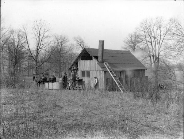
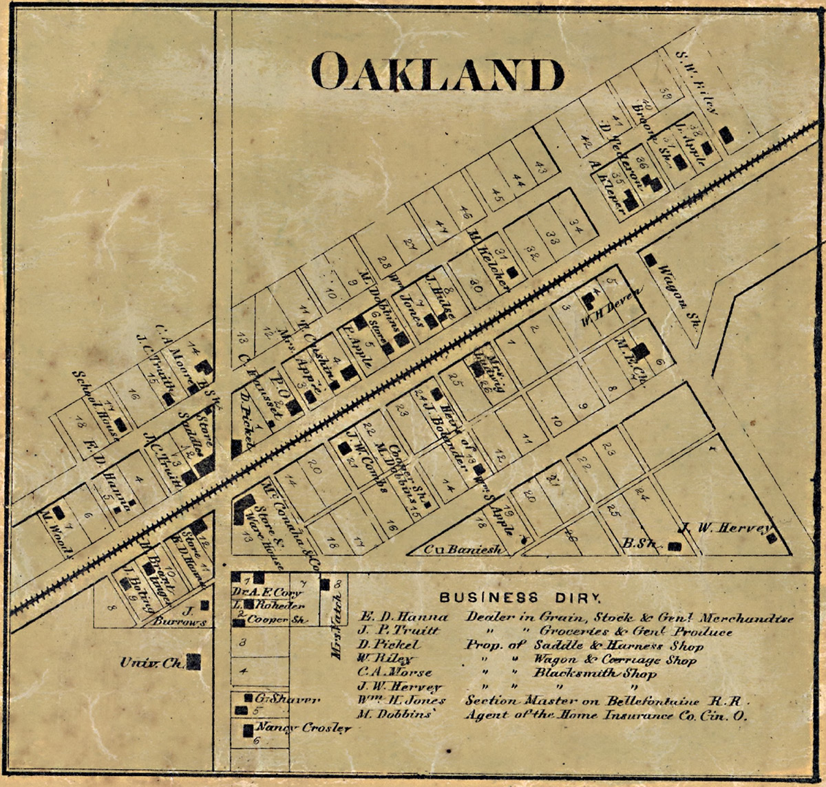
When Oaklandon was established in 1849 along the route of the Indianapolis and Bellefontaine Railroad, it was surrounded by farms and vacant land; now it is enveloped by the urban sprawl of Indianapolis and Lawrence. Late 20th century housing developments, many of them planned using winding streets or cul de sacs, can be seen to the south, west, and north of the community.

Just north of the district is the railroad right-of-way established in the late 1840s, and currently used by CSX Transportation. To the south is Pendleton Pike, once a toll road which passed directly through Oaklandon, running north along present day Oaklandon Road, and then west along what is now Broadway Street. Pendleton Pike was rerouted in the early 20th century so that it passed along the southern edge of the community, and is now a busy six lane thoroughfare lined with strip malls and other commercial activities. The district’s building stock is composed of small and medium-sized residences and outbuildings dating from the late 19th and early 20th centuries, along with two church buildings from the same era.[7]

Oaklandon never incorporated, and therefore had no official town limits, but appears never to have developed south of present-day Pendleton Pike. Until its demolition in the early 1940s, the community’s two story brick school stood at the northwest corner of Oaklandon Road and Pendleton Pike and would have alerted travelers of the small town just to the north. Today a modern retail development occupies the school’s site, but that development’s sign includes a panel bearing the words “Oaklandon Community established 1849.” Upon passing that sign and heading into the historic district, one immediately notices that the area differs from the surrounding commercial and residential area. The feeling of a small town is engendered by the relative narrowness of the streets and the older housing stock. That atmosphere is further reinforced by the small lots and modest setbacks that characterize the housing stock on Oaklandon Road, the older part of the district. This section of Oaklandon Road (from Pendleton Pike north to Broadway) is also the only street in the area with streetlights, curbs and sidewalks. The latter were initially installed for the benefit of the community’s children, who once walked along Oaklandon Road to the aforementioned school.[7]
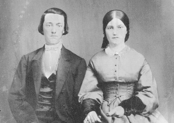
Germantown - Our Historic Neighbor

  • View Printable Version
History
  • Contributed by:
  • Views:
    10,226

A Germantown Farm
Check out the Germantown/Geist Image Gallery

The Germantown community is truly one for the history books. In searching out information about Oaklandon I happened upon the following article reprinted on Hungarovet.com. The story is credited to Jennifer Gal, wife of Dr. Sandor Gal and was likely originally published for the Log Cabin Animal Hospital website. It seems as though Dr. Gal is likely no longer associated with the animal hospital.

Germantown was just north of Oaklandon and its history offers much in the way of enlightenment for those seeking a history of Oaklandon. Many thanks to Mrs. Gal!


GERMANTOWN: A HAMLET LOST TO GEIST RESERVOIR

Orientation to Subject Matter

Geist Reservoir is interesting for many reasons. For one, it is Indiana ’s largest manmade lake, and second largest body of water, after Lake Wawasee . The Geist area is noteworthy for its wealthy and famous residents, especially the reservoir’s shoreline inhabitants who include renowned professional sports figures, politicians, local media personalities, and businesspeople. The history of the reservoir is no less interesting; Clarence Geist, a former owner of the Indianapolis Water Company forsaw a deficit in Indianapolis’s water supply, and envisioned “Geist Reservoir” to preemptively address the problem – but not without a casualty. Yes, there was an unmitigated casualty in the creation of the recreational and luxurious living locality known as Geist Reservoir. It was a tiny hamlet called Germantown , whose parcels were systematically bought up by Clarence Geist in the 1930’s, then put to their death in 1943 when Fall Creek was dammed to create the reservoir.

[ continue reading...]

Lawrence Township

  • View Printable Version
History
  • Contributed by:
  • Views:
    23,062

I found the following article concerning the history of Lawrence Township in Marion County Indiana.
It is very dated but that's history for you ;)

There are several references to "Oakland" which I assume to be referring to "Oaklandon."

The following is reprinted from Marion County, INGenWeb

Source: Sulgrove, B. R., History of Indianapolis and Marion County, Indiana, Philadelphia: L.H. Everts & Co., 1884, 785 pgs., pgs. 534-575


CHAPTER XXII.

LAWRENCE TOWNSHIP.

This township is situated in the extreme northeastern portion of the county, and is seven miles square, containing forty-nine square miles, or thirty thousand eight hundred and nineteen acres of land. It is bounded on the north by Hamilton County, on the east by Hancock County, on the south by Warren township, and on the west by Washington township. The surface of the country is generally level, except along the streams, where it is somewhat broken, and in some localities hilly. The soil is well adapted to the culture of wheat, corn, rye, barley, and most vegetables, but the culture of fruit has proved to be unprofitable during the past few years, though in a few localities this branch of agriculture has yielded a good revenue. About thirty-five years ago immense crops of peaches were raised, but the peach crop has been almost an entire failure during the last twenty years. The soil is principally clay, but consists of four grades, viz.: white clay, or beech flats; black loam of the flats; limestone or clay hills; and bottomland, or dark chocolate loam intermixed with sand. Originally the township was covered with a heavy growth of timber, consisting principally of walnut, sugar, poplar, ash, beech, hickory, sycamore, lime, buckeye, oak, and hackberry. In the lowlands, the primitive forest abounded with grape-vines, frequently growing to an enormous height. Beneath the forest and the net-work of vines grew pawpaws, leatherwood, prickly-ash, black haw, and other underbrush. At the Lawrence district fair, September, 1883, John Johnson exhibited fifty-four natural varieties of timber of the township. Nearly all the valuable timber was recklessly destroyed in the clearing of the land, or has since been sold in the market. In an early day the level lands were covered with immense sheets of water, quagmires, and ponds.

[continued...]

Historic Time Line

  • View Printable Version
History
  • Contributed by:
  • Views:
    2,431
A TIMELINE OF FAITH AND COMMUNITY:
LAWRENCE-GEIST, 1849 TO 1998

1849

Lanesville platted near Bee Line Railroad and Pendleton Pike.

1866

Lanesville's name is changed to Lawrence after the name of the post office.

1886

Population of Lawrence: 150. It has become a trading center.

First | Previous | 12345 | Next | Last