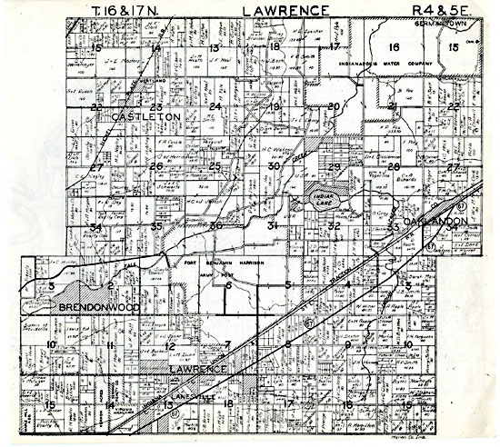
Lawrence Twp Plat Map 1938
Contributed by: Mike on Monday, December 03 2018 @ 05:10 am EST
Last modified on
Lawrence Twp Plat Map (showing land owners)
Source: Plat book of Marion County, Indiana, 1938[*1]
Courtesy: Map Collection, Indiana Division, Indiana State Library
